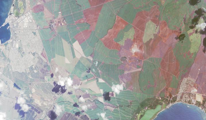
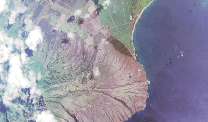
Satellite photo of central Maui. At the left is the harbor of Kahlui; airport is just off the top. North angles to the upper left. The green is active sugar cane fields; red is plowed cane fields.
Being flat for miles, this is the only economically feasible sugar production in Hawaii. When we lived on Oahu in the late 80s Oahu had two mills; Big Island had several; Maui had several including one at Lahaina. Now the Puunene mill is the only one in all the islands; (the mill at Aiea might still be in very limited use) it is about a quarter way in from the upper left. It is nostalgic for us, because every visit to Hawaii begins with a drive through the sugar cane waving in the wind.
At the right is sunny Kihei. The beach at the lower left (of the right) is Sugar or Maalaea Beach. Sugar Beach Resort, where the Roys family had condos, is the second to the last building for 3 miles. It is on the beach very near the right end of the light greee pond, which is Kealia Pond - a wildlife refuge.
Sunny Kihei extends for several miles to the right, followed by Wailea, then Makena.
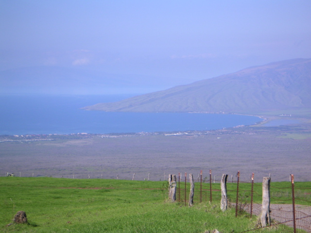
Photo of the same part of Ma'alaea Bay, including Sugar Beach (at A on the map below). North is to the right
What used to be our view (A on the map)
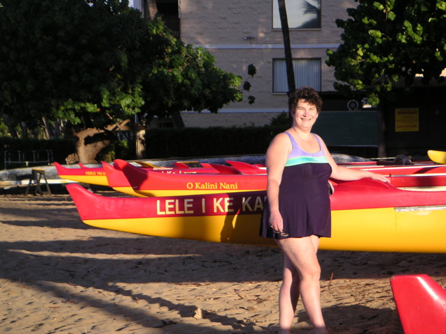
Gini on "our" beach by an outrigger canoe. Twice she went on the water in one of these and paddled for an hour
Web Cam of Maalaea Bay from North Kihei. And this link also has a good detailed map of Kihei. Sugar Beach is shown, but not labeled. At the extreme upper left Sugar Beach is the pair of buildings on Highway 31.
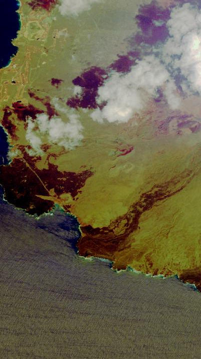
Satellite photo of McGregor
Point (B on the map)
Fits just below the above photo. The road to Lahaina and Kaanapali traverses
the water edge of the mountain. Darker green is pineapple fields. Water to the
right is Maalaea Bay, one of the prime areas for humpback whales from mid November
to early May. (North is upper left.) In the photo of Ma'alaea Bay above the point seen is McGregor. Great place for whale watching.
Satellite photo of road crossing the 1790 lava flow south of Makena to LaPerouse
Bay at the lower left (C on the map, way to the South). Sun glare mars this photo. I don't know of another place on Maui you can drive through a lava flow for miles - the prominent green line through the very dark red.
The luxury of Wailea is at the upper left. Makena is at the extreme left. The
right is the lower slopes of 10,000 foot Mt. Haleakala. (North is upper right.)
Photo looking down at the LaPerouse area from about 4,000 feet on Haleakala.
The photos of McGregor and LaPerouse were taken at D on the map, south of the winery.
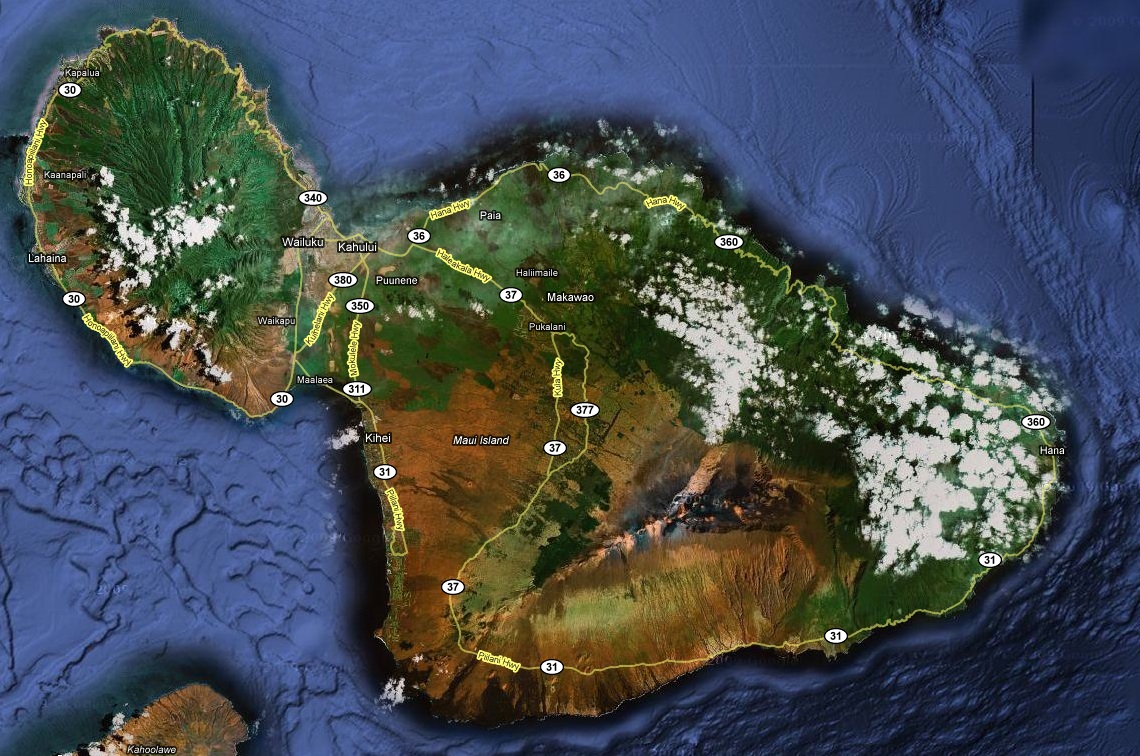
I replaced my map, but the new one doesn't have my letter labels yet. A is at the 311 highway bubble just north of Kihei. B is just left of the 30 highway bubble at lower left. C is just north of the SW corner of Maui, way south of Kihei. D is at the 37 highway bubble on the highway just above (NE of) C.
I have a complete page on * * Maui Hikes * * Enjoy!
Ron Hebron
Seattle, Washington, USA
ron_lfp at mac.com